Local: | Zulu:
Prepared | Resilient | Ready
Prepared | Resilient | Ready
Fire Weather
USGS Fire Risk Map
Fire Danger Calculator
Fire Weather Stations
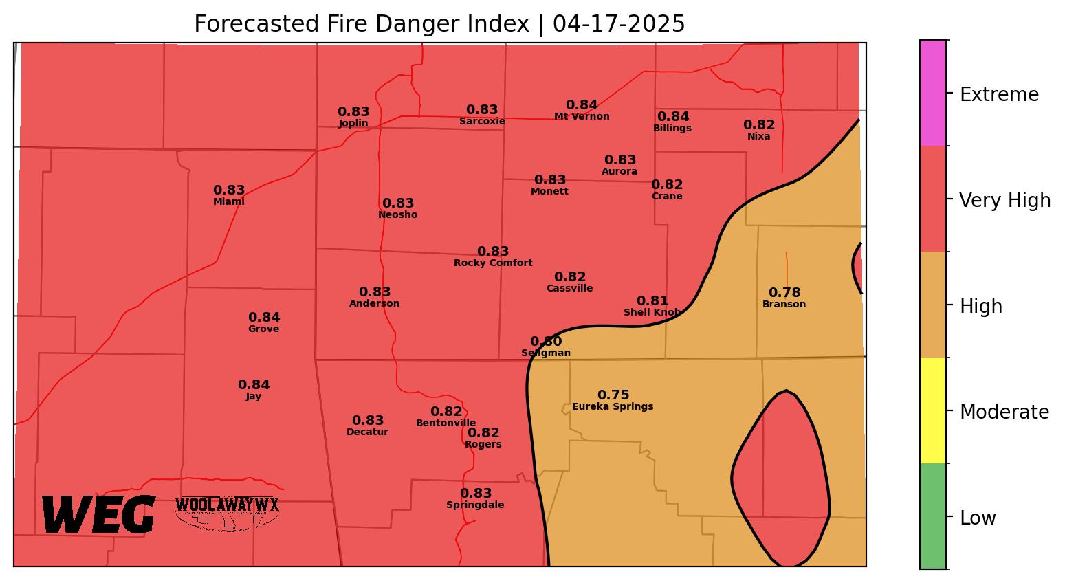
Today's Fire Weather
Plotted map of forecasted fire weather based on wind gusts, ground moisture, and minimal relative humidity values. The WEG FFDI script is in active development to improve, so expect errors and changes.
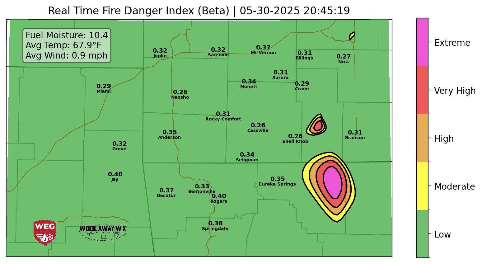
Real Time Fire Danger (Beta)
Real time fire danger calculations based on the same scale as the daily plot, just updated every 15 minutes, based on real time values, and not forecasted values. Currently, this is in beta testing and is not fully functional. Expect errors and changes.
USGS Forecast Fire Danger Maps
The USGS has several forecast maps available on their website, which work with different data sets and standards than the WEG Forecasted Fire Danger Index does.
Visit USGS Site